|
HOMEPAGE | RESEARCH | COURSES | PORTFOLIO | CONTACT/C.V. |
| RESEARCH |
|
|
| OLD |
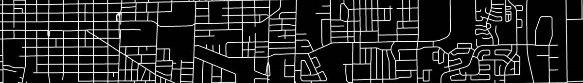
Reading the street network, one component of the urban landscape, from left to right as a text reveals a story of the development of the city. The oldest areas, located on the left, are in a near perfect grid owing to the uniformity of the original survey. Moving right, the grid is disrupted as newer developments grew organically at the fringes of the original city. Next is modern suburbia; its curving streets look like a bowl of noodles. Although this chaos appears to be unplanned, it is actually the most regulated area of the city. At the far right is the current urban fringe, comprising low density development melting into the surrounding rural areas. My research exposes the political, technological and socio-economic structures that are etched in the urban landscape. Using GIS to read and analyze urban forms reveals the conditions which created the city at each stage of its development. Opportunities exist for both graduate and undergraduate research dealing with urban form, urban planning, heritage preservation, and social landscapes. See the portfolio on this site, as well as my C.V. for an overview of my research projects. Feel free to contact with me any questions you may have.
|
NEW |